

iPad W/ GPS Topo Maps
It's easy enough to get turned around navigating a major city's downtown, and everyone with a smart phone turns to their map application to get them headed in the right direction. When traveling offroad it is exponentially easier to get on the wrong track. Some trails have many unmarked spurs that dead end.
In the past I would travel with a combination of a Magellan Vehicle GPS, topographic maps, and guide books for the area if I could find them. Even with these three items I often drove down the incorrect road only to find out a mile later when it ended abruptly, or I would drive remarkably close to my destination without realizing I was there yet.
The Magellan GPS is great on the street. Punch in an address and you will be directed there. Off road it was good on a few main fire roads, but other than that it doesn't have any map data. I would use it for the GPS coordinates and match them up with the coordinates on the paper map, or way points in a guide book.

Any 3G or 4G iPad had a true GPS chip in it. What this means is that even without WiFi or a cellular connection the iPad can get a fix on your location. The Google maps software requires internet in order to download the specific map for your location, and more likely than not the 4wd road you are on is not included in Google's map data.
I have been using "Topo Maps" from www.topomapsapp.com which can be purchased for only $7.99.
If you don't have a 3G iPad one can purchase a used iPad 3G off ebay. They are going for approximately $100 for the first generation.
It's also possible to get an external Bluetooth GPS receiver to use if you already own a WiFi only iPad. They cost approximately the same as a used iPad that already has a GPS chip. I would keep the newest generation iPad at home and purchase a dedicated overland iPad.
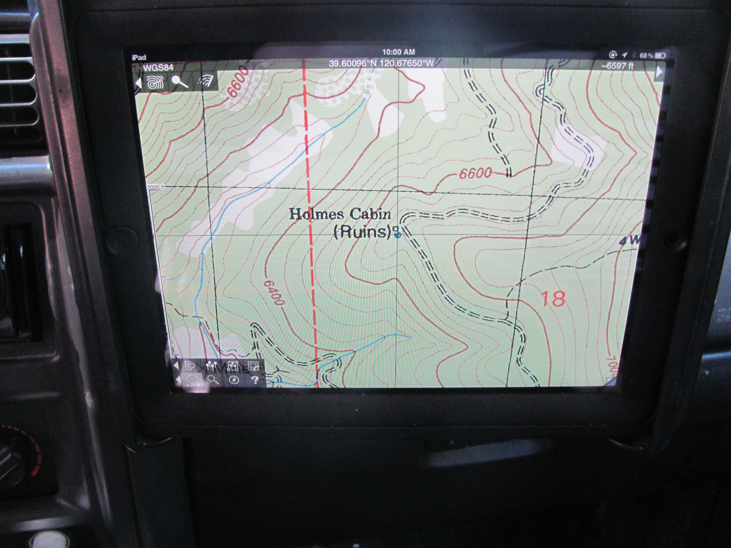
The key to the Topo Maps app is that the maps are free. They are high resolution scans of the U.S. Geological survey maps. They are also stored in the iPads memory, so you must download them before your trip. I would recommend at least a 32gb iPad. I have over 15gb of maps on mine currently and it only covers a few states. The detail is incredible, and I have found plenty of old cabins and other ruins that are marked on the map but otherwise unnoticeable.
When using the app it's also important to note that the app will not give directions like city map software. It will load a high resolution USGS map and place a blue dot on your location. One still has to plan a route, but it takes a lot of the stress and guessing out of weather or not you are at a particular intersection and which way to go.
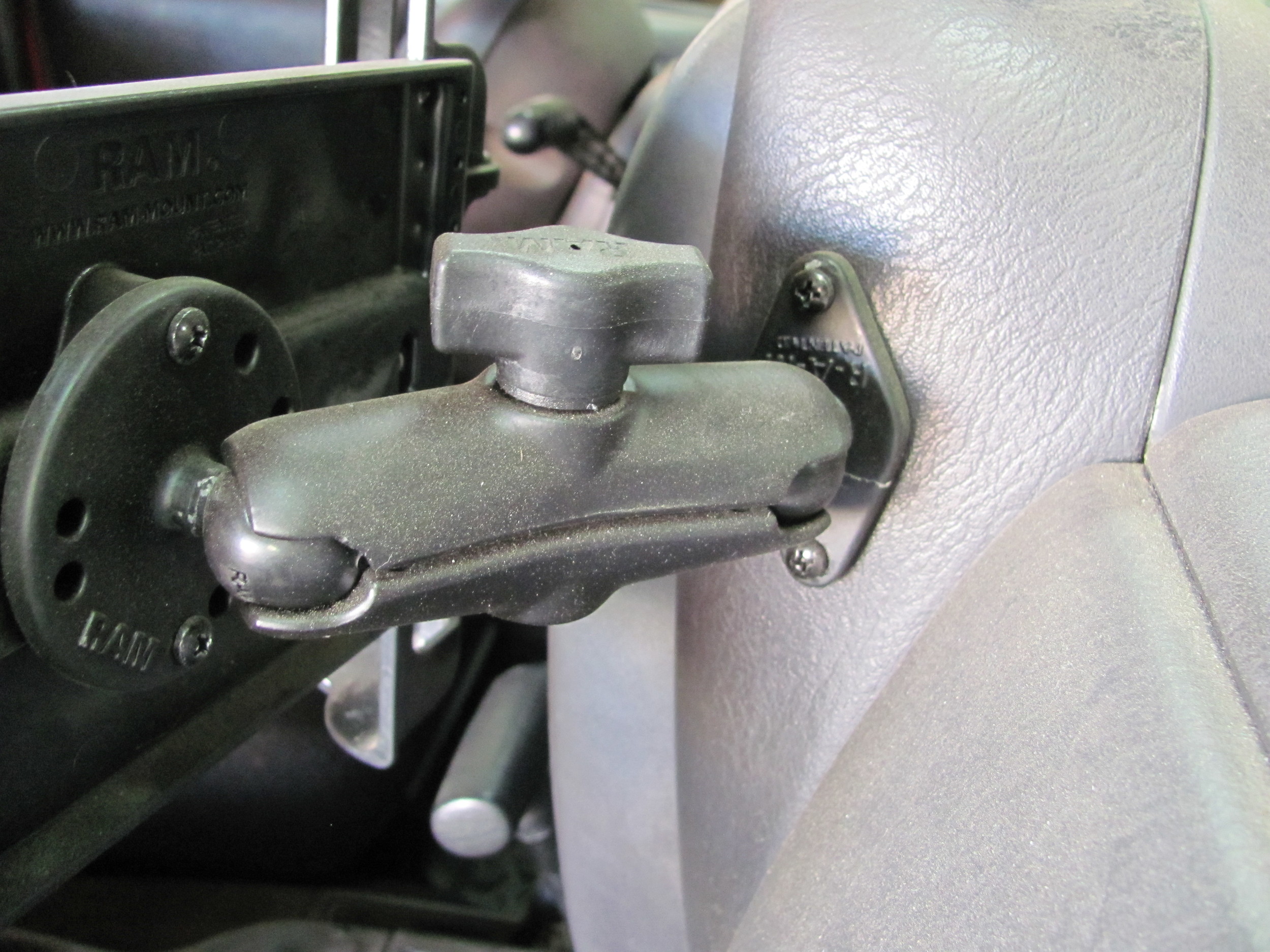
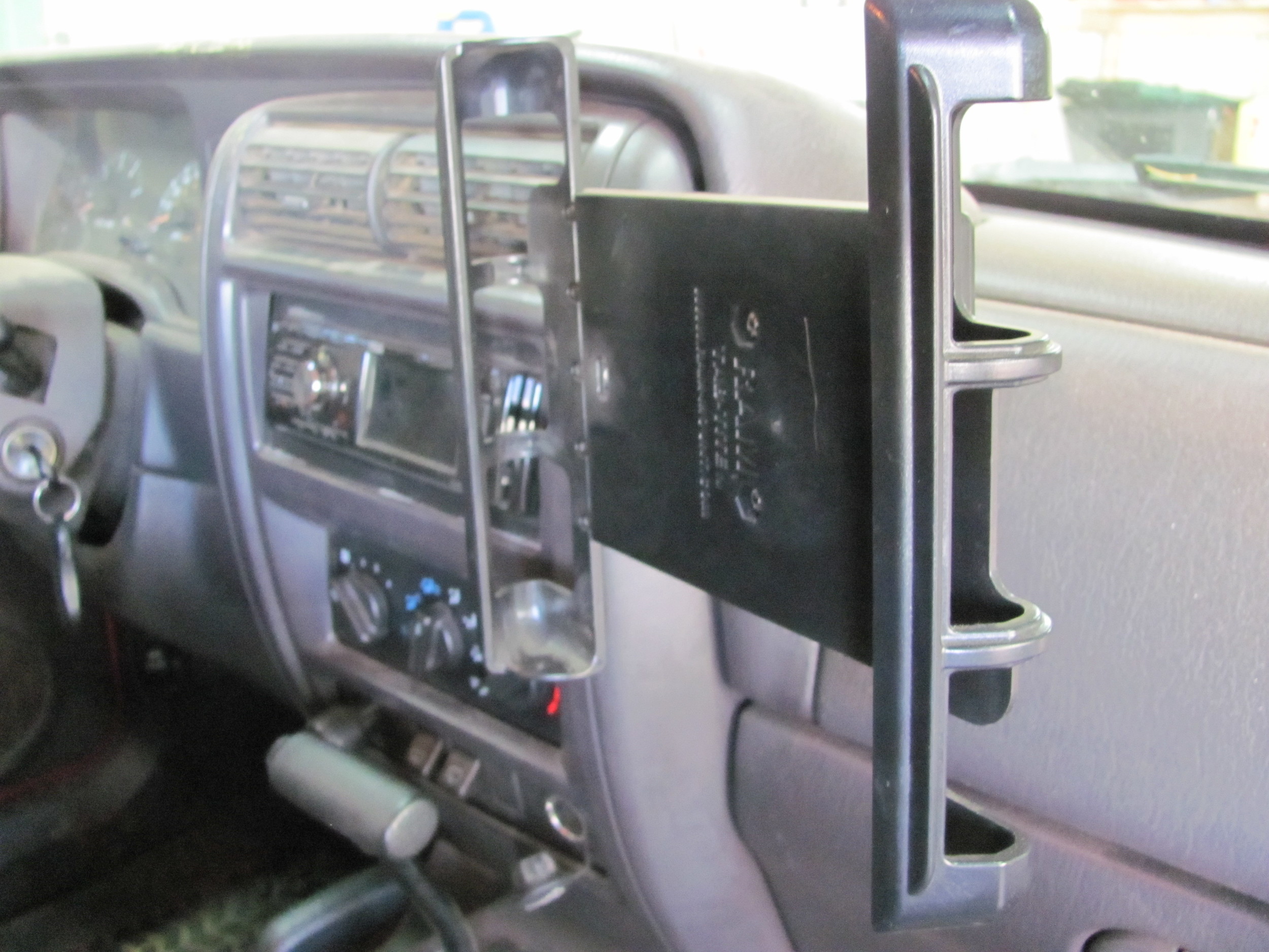
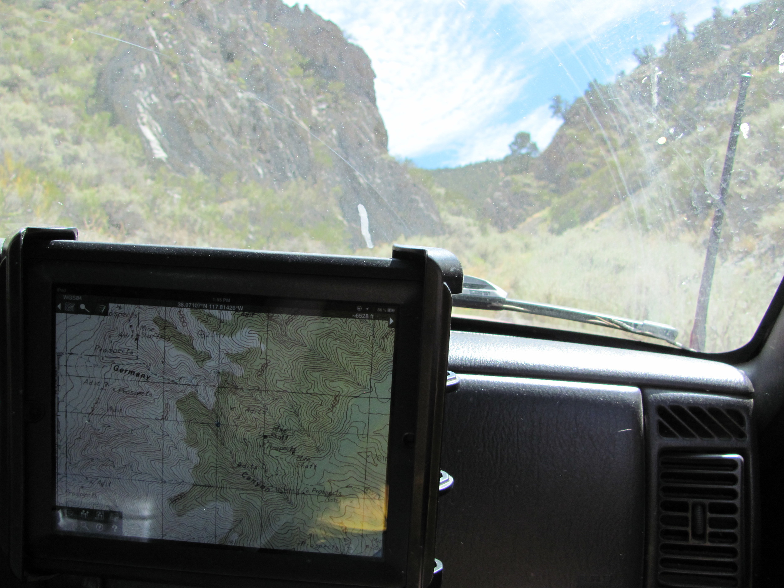
In order to easily view the iPad while driving I paired the iPad with an ultra durable OtterBox Defender Case and a vehicle mount from Ram Mounts.
The install of the Ram Mount was easy. I chose a convenient location on the dashboard where the iPad could be positioned for viewing by either the driver or passenger. To install I used two supplied bolts with a large washer and nut on the inside of the dash trim. This install has been trouble free for thousands of miles to date.
I would recommend this setup to any overland enthusiast. For under $200 you can confidently know which intersection you are at and track your progress as you drive. I do still bring my maps and books when we head out, but the maps are used for a large scale view. For example when planning a route across the sierras. And the books are often filled with interesting fun facts about a particular area.